Chaco Canyon
Ceremonial centre with great houses aligned to lunar standstills. Connected to outliers by 650+ kilometres of engineered roads.
Chaco Canyon is a demanding place to build a regional centre. Winters are cold, summers are hot, rainfall is limited, and farming can fail when precipitation arrives at the wrong time. Yet between the mid-ninth and early twelfth centuries, Ancestral Pueblo communities raised immense stone buildings here and connected them to settlements across the Four Corners region.
The canyon in northwestern New Mexico was not an isolated settlement surrounded by emptiness. It sat at the centre of a wide cultural network. Roads, shared architectural forms, pottery, timber, turquoise, shell, and ritual practices linked Chaco with communities more than one hundred kilometres away. Modern park boundaries protect only part of that landscape.
Great houses were planned before they were built
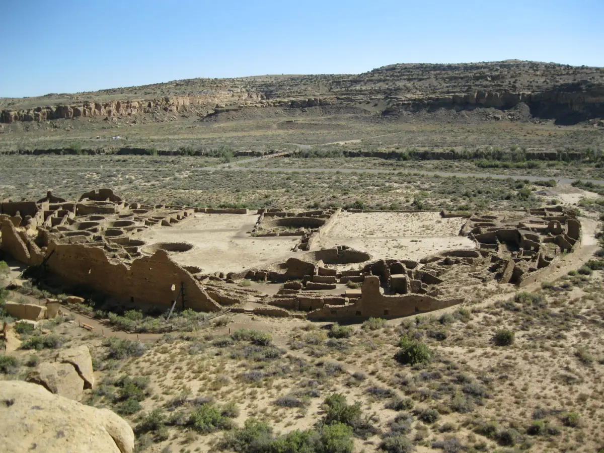
Chaco's most distinctive buildings are known as great houses. Pueblo Bonito, Chetro Ketl, Una Vida, Hungo Pavi, Pueblo Alto, and other complexes contained large rooms, multiple storeys, plazas, and circular spaces called kivas. Unlike villages that expanded one household room at a time, major parts of these buildings were laid out according to formal plans.
Pueblo Bonito grew across several centuries and eventually contained hundreds of rooms. Its curved outer wall encloses a dense arrangement of room blocks and kivas. Some walls were thick enough to carry four or more storeys. Carefully shaped sandstone formed visible veneers around rubble cores, while beams and roofing timbers were brought from mountain ranges many kilometres away.
Calling these structures apartment buildings gives a misleading impression. Some rooms were used domestically, but many lack the hearths and everyday debris expected from continuous household occupation. Great houses may have combined ceremonial, political, storage, administrative, and residential functions. Their use probably changed during festivals, trading gatherings, seasonal visits, and different periods of construction.
Kivas, plazas, and gatherings
Kivas are circular or partly underground rooms associated with Pueblo social and ceremonial life. Small kivas occur within great houses, while great kivas such as Casa Rinconada could hold much larger gatherings. Their features include benches, hearths, floor vaults, and carefully organised entrances.
Archaeologists can describe architecture and deposits, but present Pueblo knowledge remains essential to understanding these spaces. Ceremonial meanings are not always public, and modern researchers are not entitled to every detail. Descendant communities identify Chaco as a place of migration, gathering, memory, and spiritual power rather than an abandoned archaeological puzzle.
The plazas between buildings created room for people who did not live permanently in the great houses. Feasting, exchange, ceremonies, and public events could bring temporary populations into the canyon. This helps explain how monumental spaces operated even if the resident population was smaller than early excavators imagined.
Roads across a regional system
Straight road segments extend from the canyon toward outlying great houses. Some cross difficult terrain by means of ramps and stairways cut into rock. More than 150 great houses outside the canyon have been connected in some way to the broader Chacoan system, although they were not all occupied at the same time or controlled in the same manner.
The roads did not function exactly like modern transport routes. Some lead toward important landforms or continue beyond obvious destinations. They could carry travellers and goods while also organising ceremonial movement and relationships with the landscape.
Trade brought marine shell, copper bells, macaws, and other materials from distant regions. Turquoise was worked in large quantities. These finds show long-distance connections, but they do not prove that Chaco ruled a single empire. Archaeologists continue to debate whether the regional system was held together mainly by ritual authority, economic exchange, political hierarchy, pilgrimage, kinship, or a changing combination of these forces.
Watching sky and water
Many great houses align with cardinal directions or positions of the sun and moon. The most famous solar marker at Fajada Butte uses slabs of rock and carved spirals to mark changing sunlight, although movement of the slabs has altered the effect. Some alignments are deliberate; claims that every wall or road encodes a celestial event go beyond the evidence.
Water demanded equal attention. Residents built channels, terraces, and other features to direct runoff and limit erosion. Maize, beans, and squash were cultivated in and around a landscape where harvests varied sharply. Research continues over how much food was produced locally and how much arrived from outlying communities.
Timber tells a similar story. Large construction beams came from forests far from the canyon. Transporting them without wheeled vehicles or draft animals required organised labour and durable regional relationships. Monumental architecture depended on distant ecosystems as well as local stone.
People moved; they did not disappear
New great-house construction slowed during the twelfth century, and Chaco's role as a regional centre changed. Drought and unpredictable rainfall affected farming, but climate alone does not explain political and social reorganisation. Communities shifted toward the northern San Juan, the Chuska Mountains, the Rio Grande Valley, Zuni and Acoma country, and the Hopi mesas.
Those movements belong to the histories of present Pueblo peoples. Navajo communities also hold deep historical and sacred connections to the canyon. The old term "Anasazi" is avoided by many descendant communities; Ancestral Pueblo people is more accurate and respectful in this context.
Early excavation removed human remains and important objects to distant museums, often with little regard for Indigenous authority. Protection has improved, but erosion, visitation, energy development near the wider cultural landscape, and the legacy of old excavations continue to shape the site.
Chaco's masonry can look silent from the canyon floor. It becomes more intelligible when the buildings are placed back among roads, farms, mountains, gatherings, and descendant knowledge. The great houses were nodes in a living regional world, not monuments left by a people who vanished.