
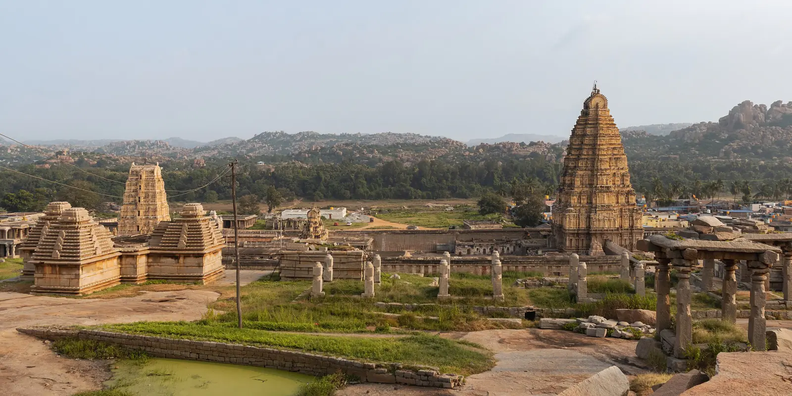
Hampi (Vijayanagara)
Capital of the Vijayanagara empire, spread among granite hills with temples, markets, waterworks, palaces, and fortified royal enclosures.
At Hampi, the landscape seems to have supplied half the architecture. Granite hills break into great rounded boulders along the Tungabhadra River. Builders fitted walls between them, quarried them for pillars and steps, and used the ridges as natural lines of defence. Temple towers rise above banana fields. Long market streets end at shrines. Water channels appear among ruined halls and continue toward cultivated ground.
These remains belonged to Vijayanagara, the capital of an empire that dominated much of southern India between the fourteenth and sixteenth centuries. Hampi is the name of the present village and the World Heritage property, while Vijayanagara, “City of Victory,” was the historical metropolis spread across the wider landscape.
The distinction matters because there was never a single compact palace city waiting to become a ruin. Sacred centres, royal compounds, neighbourhoods, farms, reservoirs, roads and defensive zones occupied an area measured in thousands of hectares. UNESCO records more than 1,600 surviving structures and archaeological features. Many more lie beneath fields or survive only as altered ground.
Before the imperial capital
The Tungabhadra landscape was sacred before Vijayanagara’s rulers made it their capital. Local traditions connected its hills and river with episodes from the Ramayana. The Virupaksha temple, dedicated to a form of Shiva, had an earlier history of worship and patronage. The empire enlarged this religious landscape rather than beginning on empty ground.
Vijayanagara emerged in the fourteenth century amid changing powers across the Deccan and southern India. Its rulers drew resources from a broad, diverse territory and supported temples, armies, irrigation and long-distance trade. The capital grew into a political stage on which royal authority could be seen in processions, audiences, festivals and gifts to sacred institutions.
Foreign travellers described a large, wealthy city with crowded markets. Their accounts are vivid but selective. Visitors tended to notice jewels, horses, ceremonies and royal scale. Archaeology adds the quieter systems that made those spectacles possible: grain storage, roads, drains, wells, quarries, workshops and agricultural land.
Hampi was not culturally uniform. UNESCO notes the use of Indo-Islamic architectural elements in secular buildings such as the Lotus Mahal and Elephant Stables. Muslim officers, merchants and communities formed part of Vijayanagara’s social world, while Jain and Hindu monuments occupied the capital and its surroundings. The city’s history is poorly served by a simple story of two fixed religious blocs.
Sacred streets and a royal centre
The surviving city is often divided into sacred and royal zones, although life crossed those modern categories. Around the Virupaksha and Vitthala temples, broad streets lined with pillared pavilions accommodated commerce and festival movement. Chariots carrying deities could travel along these routes while markets, pilgrims and residents occupied the same urban space.
The Vitthala complex displays the mature form of Vijayanagara temple architecture. Enclosures, gateways, pillared halls and ceremonial pavilions surround the sanctuary. A small shrine shaped like a stone chariot stands in the court. It is a representation of a wheeled temple vehicle, not a chariot that once rolled through the city. Its popularity in photographs can distract from the larger complex of water, procession and worship around it.
South of the main sacred zone, the royal centre contained audience platforms, walled compounds, gateways, baths and administrative spaces. The surviving stone foundations once supported buildings that also used brick, timber, plaster and painted decoration. Their disappearance makes the royal quarter look emptier than it was.
The Mahanavami Dibba, a high ceremonial platform, preserves carved processions of animals, dancers, soldiers and courtly figures. From it, rulers could preside over festivals and displays. The reliefs are evidence for a political world, but they are not a documentary film of one event. They select and order what royal power wanted viewers to see.
Engineering water through stone
Vijayanagara depended on the Tungabhadra and on seasonal rain. Channels carried water toward agricultural areas, tanks and the urban core. Stepped wells stored it. Stone aqueducts crossed uneven ground. Reservoirs captured runoff from the surrounding hills.
These works were practical and political. Reliable water supported households, gardens, animals, crops and ritual. Control of canals also connected the court with communities that built, maintained and depended on them. Some channels remain part of the working landscape, a continuity that makes the boundary between archaeological site and present countryside difficult to draw.
Fortifications followed the same logic of adaptation. Walls used granite ridges and boulder fields rather than imposing a neat geometric perimeter. Gates narrowed movement. Cultivated and inhabited land existed within successive defensive lines. An attacker approaching the royal centre would pass through a landscape designed to slow, channel and expose movement.
What happened in 1565
In 1565, Vijayanagara’s forces were defeated by an alliance of Deccan sultanates at the Battle of Talikota. The capital was subsequently attacked and extensively looted. Courtly and political life shifted away, and large parts of the metropolitan centre were not rebuilt.
The word “abandoned” needs care. The imperial capital ceased to function, but the landscape did not become empty. Worship continued at Virupaksha. Farmers used fields and water systems. Small communities lived among the remains. Later repairs, colonial archaeology and modern conservation all changed what survives.
Nor was the destruction a simple religious ending to a purely Hindu city. Rival states shared military practices, architectural forms, languages and personnel. Vijayanagara itself employed Muslims, and the sultanates fought one another as readily as they formed alliances. The battle ended one political order; it did not divide the Deccan into tidy cultural worlds.
A heritage landscape where people live
Hampi entered the World Heritage List in 1986. It was placed on the List of World Heritage in Danger from 1999 to 2006 after bridge and road proposals threatened the archaeological landscape. That episode helped establish a broader management approach, but development pressure has not disappeared.
The protected property covers 4,187 hectares and sits within a much larger buffer zone. Villages, farms, pilgrimage, tourism and infrastructure all operate within or around it. Conservation therefore involves choices about transport, housing and livelihoods as well as stone repair.
This scale is Hampi’s greatest strength. A visitor can follow the relationships between river, temple, market, fortification and field. The city becomes understandable as a network rather than a collection of photogenic monuments. Granite gave Vijayanagara its material character, but water, trade, ritual and human movement made the capital work.