
Poverty Point
Concentric earthen ridges in Louisiana built by hunter-gatherers. Among the largest earthworks ever made by a non-agricultural society.
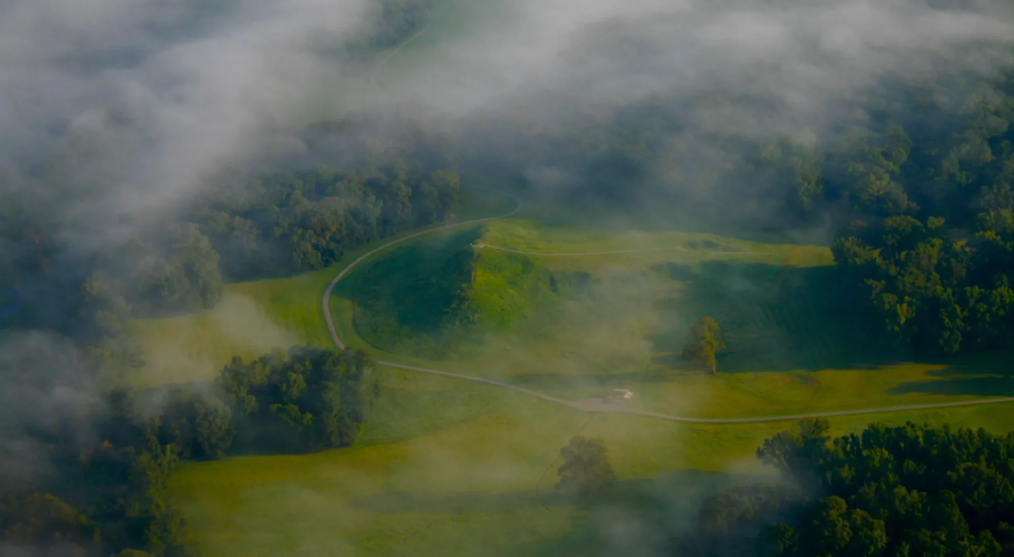
The earthworks at Poverty Point are difficult to understand from ground level. The land rises and falls gently. Low ridges disappear beneath grass. A broad open plaza looks almost natural. Only from above does the full arrangement become clear: concentric arcs, aisles, mounds and a central space organised on a scale that would have required thousands upon thousands of journeys with soil carried by hand.
The people who made this landscape left no palaces, royal inscriptions or evidence of an agricultural state. They lived by hunting, fishing and gathering wild foods. That is exactly why Poverty Point matters. It overturns the old assumption that monumental building required kings, farming surpluses and a rigid urban hierarchy.
A designed landscape on Macon Ridge
Poverty Point stands on Macon Ridge in northeastern Louisiana, above the lower and wetter land beside Bayou Maçon. Most of the main complex was created between about 1700 and 1100 BCE, a period archaeologists in North America call the Late Archaic.
Its best-known features are six concentric, semi-elliptical ridges separated by shallow depressions. The outer arc spans roughly 1.1 kilometres. A large, level plaza occupies the open side of the arrangement, while mounds rise around and beyond the ridges. Mound A dominates the complex and is among the largest ancient earthen constructions in North America.
The surviving landscape is not one simple building phase. One mound, Mound D, was added by a later community roughly two thousand years after the main Poverty Point period. Other elements have been altered by farming, erosion and a modern road. Archaeology has also revealed features that are no longer obvious on the surface, including large circles of postholes in the plaza.
Earth moved one load at a time
There were no draft animals, metal shovels or wheeled carts at Poverty Point. Soil was dug, carried and placed with human labour, probably in baskets or hide containers. Builders selected different earths and prepared surfaces before adding new layers. The result was not simply a heap. Mounds and ridges required decisions about drainage, slope, stability and the relationship between each element.
Some geoarchaeological studies suggest that major construction episodes could be completed surprisingly quickly. Speed does not make the work easy. It implies that large numbers of people could be organised, fed and brought together for a shared purpose.
Exactly who directed that labour is unknown. Poverty Point has not produced a ruler's tomb or an administrative archive. Monumental coordination existed here, but the political structure behind it remains open to interpretation.
Was it a town, a gathering place or both?
Archaeologists have debated whether the ridges supported permanent houses, temporary camps or structures used during repeated gatherings. Hearths, postholes, tools, food remains and thick deposits of objects show sustained human activity. UNESCO describes the complex as serving residential and ceremonial purposes, but the balance between the two may have changed over time.
The site contains no confirmed human burials from its principal period. Domesticated crops also do not dominate the food evidence. People relied on the abundant rivers, wetlands and forests of the Lower Mississippi Valley: fish, game, nuts, fruits and other wild resources.
That economy should not be confused with isolation. Poverty Point was connected to an extraordinary movement of raw materials. Stone and minerals arrived from regions hundreds of kilometres away. The official site reports more than 78 tons of non-local rock, some transported from as far as about 800 miles. Rivers would have provided much of the transport network.
These materials became projectile points, tools, ornaments and other objects. Small baked-clay pieces known as Poverty Point objects were probably used to control heat in earth ovens. Their many shapes may reflect different cooking needs, traditions or social meanings; they were more than decorative curiosities scattered across the site.
A society visible through things, not names
No written account tells us what the builders called Poverty Point or what ceremonies took place there. Even the modern name comes from a nineteenth-century plantation established nearby. Archaeologists therefore work from patterns: where objects were found, how soils were placed, what people ate, which materials travelled and how the built landscape directed movement.
The absence of names can tempt writers to fill the gap with mystery. It is more useful to recognise what the evidence already shows. Communities without agriculture on the scale of later mound-building societies planned an integrated monumental landscape. They maintained far-reaching relationships and returned to, or lived at, the site for generations.
Their achievement was not a primitive version of a later city. It was a different way of gathering people and organising labour in a rich riverine environment.
Preservation beneath the grass
Poverty Point became a UNESCO World Heritage Site in 2014 and is managed by the State of Louisiana. Much of its archaeology remains below ground. That buried evidence is one reason the quiet ridges are so important: dramatic reconstruction would destroy the deposits that can answer future questions.
Erosion, vegetation, visitor movement and the road through the property all require monitoring. The site's scale also makes interpretation difficult. A visitor can stand on a ridge without realising that it belongs to a pattern more than a kilometre wide.
Poverty Point rewards that change in perspective. Seen as a whole, the landscape records planning on an immense scale. Seen closely, it preserves the individual loads of earth, broken tools and traces of meals from which that monument was made.
Sources
- UNESCO World Heritage Centre: Monumental Earthworks of Poverty Point
- Poverty Point World Heritage Site: people, mounds and artefacts
- Louisiana Division of Archaeology: Poverty Point World Heritage initiative
- US National Park Service: Monumental Earthworks of Poverty Point
- ICOMOS: World Heritage nomination evaluation for Poverty Point