Timgad
Roman colony founded under Trajan with a formal street grid, forum, theatre, baths, and later expansion beyond its original plan. Its surviving layout makes Roman urban planning unusually legible.
From above, Timgad can look like the Roman Empire reduced to graph paper. Two broad streets cross at right angles. Smaller streets divide the ground into blocks. A forum, theatre, baths and markets sit where a planner appears to have put them before the first stone was laid.
That impression is real, but incomplete. Timgad did begin as a planned Roman colony. It also outgrew its original walls, changed with its inhabitants and remained part of North African history long after the clean geometry of its foundation had ceased to contain it. The most interesting Timgad is not a perfect model city frozen in sand. It is the city that escaped the model.
A colony founded under Trajan
The colony was established around 100 CE during the reign of the emperor Trajan. Its full Roman name, Colonia Marciana Ulpia Traiana Thamugadi, honoured the emperor and members of his family. It stood north of the Aurès Mountains in what is now Algeria, not far from Lambaesis, the principal base of the Third Augustan Legion.
Timgad is often described as a military camp. The resemblance comes from its orderly plan, but the settlement was a civilian colony. Veterans and their families were among the people for whom it was founded. The colony offered land, Roman civic institutions and a conspicuous statement of imperial presence in a region that already had its own communities, economies and political traditions.
The distinction matters. Timgad was not an empty square stamped onto an empty landscape. It was a Roman foundation on Numidian soil, connected to farms, roads, settlements and the military zone around the Aurès.
Streets before houses
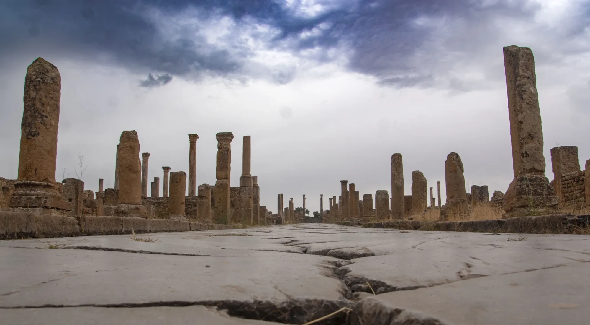
The original town was enclosed in a roughly square perimeter. Its two principal routes were the decumanus, running broadly east to west, and the cardo, running north to south. Colonnades lined parts of the streets, while drains and water infrastructure supported the daily life behind the monumental facades.
At their meeting point lay the civic centre. The forum gathered political, legal and commercial activity into a formal public space. Nearby stood a theatre cut partly into the slope, public baths and markets. The western approach was later marked by the structure now called the Arch of Trajan, a three-bayed monumental gate that replaced an earlier entrance as the city expanded.
The surviving plan is unusually easy to read, which is why Timgad appears so often in books about Roman urbanism. Yet a street grid tells us how space was organised, not exactly how every resident used it. Houses were altered, shops opened onto public routes, rooms changed function and wealth was distributed unevenly. A city is always messier than its plan.
The moment the plan became too small
By the middle of the second century, Timgad had spread beyond its first enclosure. This growth is one of the most revealing parts of the site. New districts and major buildings appeared outside the original square, including temples, baths, markets and large private houses. Under the Severan emperors in the late second and early third centuries, the city experienced a particularly prosperous phase.
The expansion did not simply repeat the first grid on a larger scale. Roads, topography, earlier property lines and new needs produced a less regular urban fabric. The celebrated plan had not failed; it had become the centre of a living city that no longer fitted inside it.
Among Timgad's better-known discoveries is a building identified as a public library from an inscription recording the money left for its construction. The identification is important because purpose-built libraries are difficult to recognise archaeologically. It also gives a glimpse of the civic ambitions of local benefactors, who could turn private wealth into a public monument and a lasting name.
A city after the high empire
Timgad did not end when Rome's period of greatest territorial power ended. Christian buildings, changes to houses and the later Byzantine fortress south of the first town all belong to subsequent chapters. Bishops from Thamugadi appear in the disputes that divided North African Christianity, including the conflict between Catholic and Donatist communities.
Political control changed, regional trade shifted and parts of the urban system became harder to maintain. The settlement contracted over time, but the old story of a complete city simply abandoned and swallowed by the desert is too tidy. Different areas had different afterlives, and stone from ancient structures remained useful long after their original functions disappeared.
The visible ruins therefore combine several cities: Trajan's planned colony, the prosperous settlement outside its walls, the Christian city and the fortified landscape of late antiquity.
Excavation created the Timgad we see
European travellers recorded the ruins before large-scale excavation began under French colonial rule in Algeria. From 1881, teams directed for many years by architect Albert Ballu cleared streets and buildings, consolidated masonry and produced plans that still shape modern understanding of the site.
Those records are invaluable, but excavation was not neutral. Early teams often sought monumental Roman architecture, removed later deposits and restored selected structures to make the ancient plan legible. The work took place within a colonial project that used Roman Africa to construct its own political story about Algeria.
Modern researchers return to excavation reports, photographs and archives to recover details that the cleared site no longer preserves. This does not make the ruins inauthentic. It reminds us that an archaeological park is both an ancient place and the result of decisions about what to uncover, keep, rebuild and explain.
Reading the city without turning it into a diagram
Timgad became a UNESCO World Heritage Site in 1982 because of the clarity of its Roman plan and the range of monuments that survive. Conservation now has to address erosion, unstable masonry, visitor pressure and development around the protected area.
The grid remains the obvious way into the site. It should not be the way out. Walk beyond the first square and Timgad stops behaving like a textbook illustration. Its expansion, later buildings and excavation history reveal a city shaped by people who repeatedly adapted an imperial plan to circumstances its founders could not predict.